EO Image Acquisition Planner
To maximize imaging opportunities
As Earth Observation (EO) satellite/payload operators, your primary goal is to satisfy as many imaging requests as possible. Doing this with manual plans is painful because you need to account for multiple actions such as station keeping, flight software updates, multi-band downlinks etc. in addition to your imaging activities.
Leanspace simplifies this by enabling easily adjustable plans, allowing for optimal payload usage and providing peace of mind.
Best for:
- Single EO satellite
- Small constellations (up to 5 satellites)
- Payload operators relying on a 3rd party fo fly their satellite
- Operators of the satellite platform and payload
EO Image Acquisition Planner
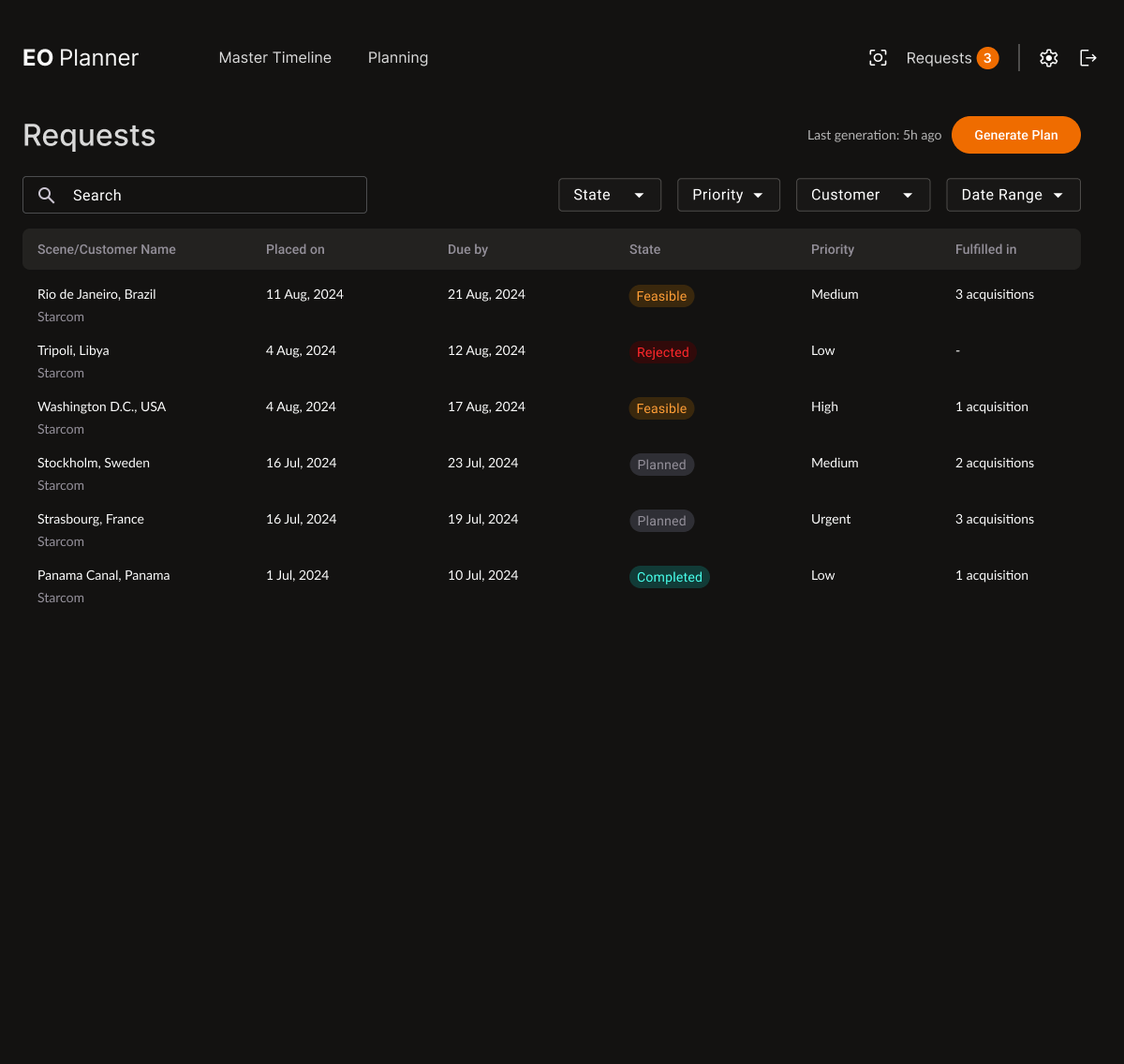
Receive and track your image capture requests.
Manage the life cycle of requests based on the plan execution.
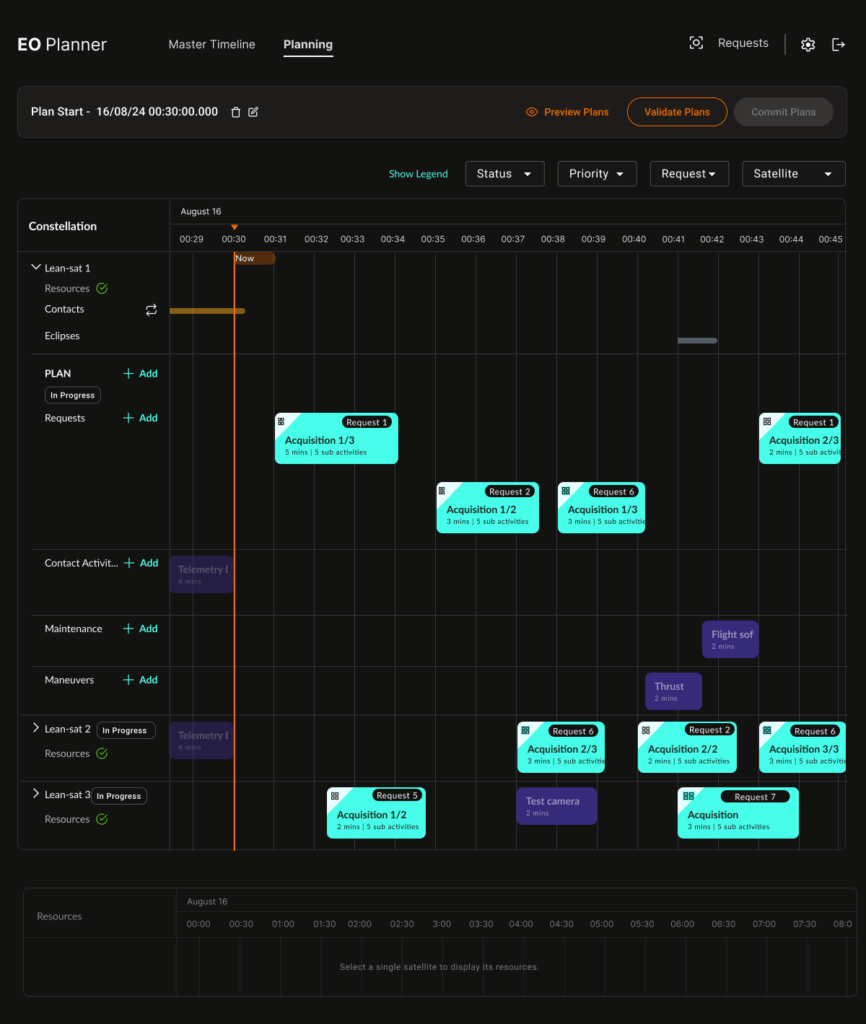
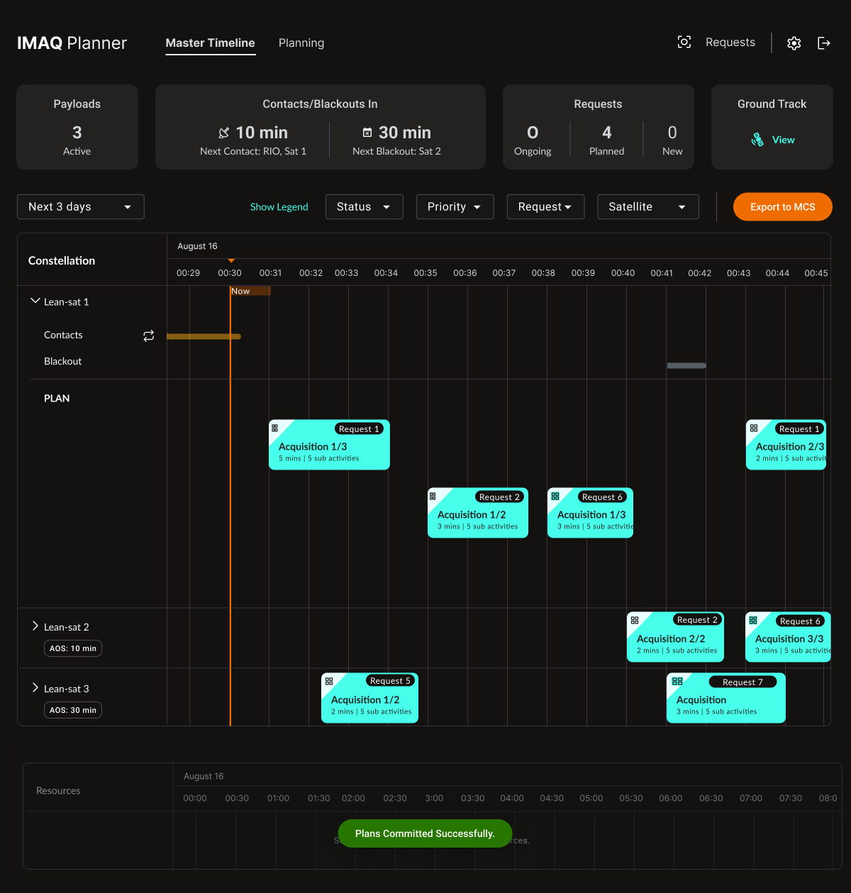
Create plans for your preferred time horizons. Replan in just a few clicks.
Security mechanisms ensure only validated and committed plans can be used.
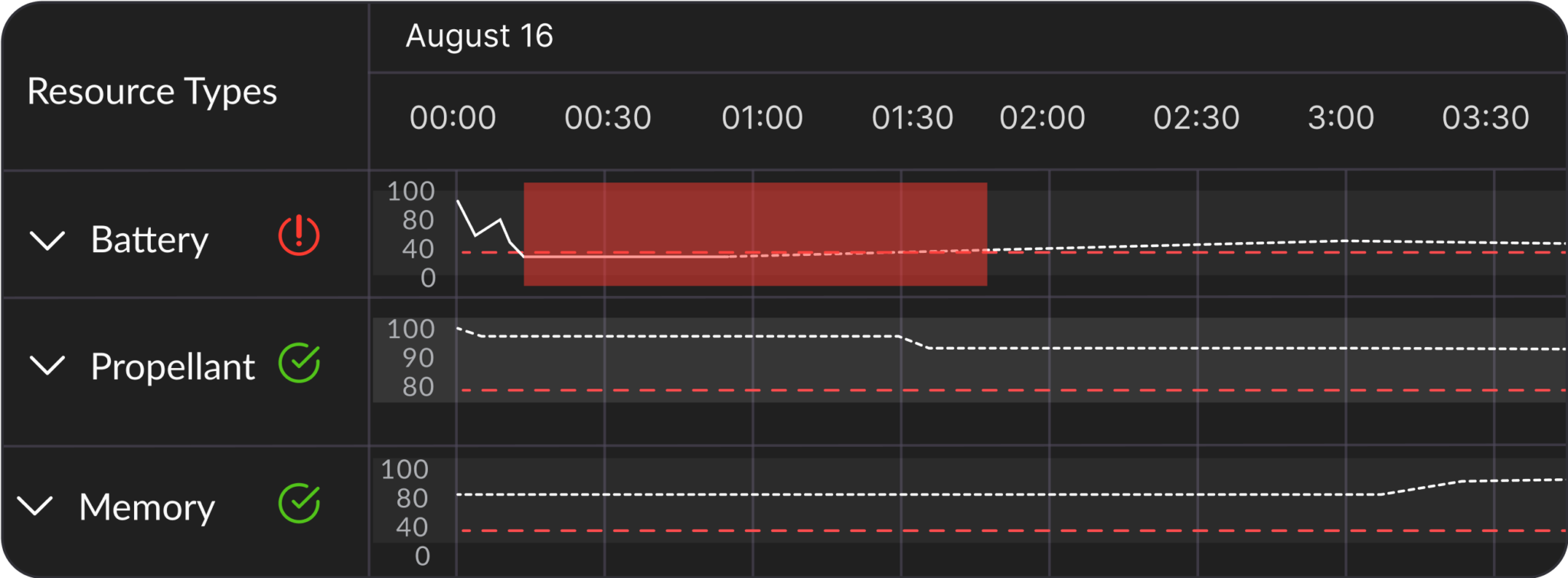
Simulate the resource usage for your current and draft plans.
Adjust the resource models using the latest telemetry to increase simulation precision.
Interface with any satellite provider allowing you to sync with their system, submit the payload plan and receive telemetry.
Built with your needs in mind
Ensure Optimal Fleet Usage
Fulfil the ideal amount of image requests while staying within resource constraints.
Adapt to Urgent Requests
Handle urgent customer requests by adjusting your payload operational plans when needed.
Support All Customer Needs
Handle multiple types of requests to support changing imaging requirements.
Switch Satellite Platforms
We are satellite agnostic, allowing you to change bus and Ops-aaS providers without fear of compatibility issues.
Technology that's designed to solve real-world problems
Escape vendor lock-in
Leanspace provides you with the application’s source code, giving you full control over who can modify it—whether it’s the Leanspace team, yourself, or any third party.
Embrace cloud technologies
Leanspace gives you the freedom to benefit from cloud native architecture in a safe manner that complies with your needs. Deploy on-premise or on your choice of public cloud providers.
Improved operations
Leanspace allows you to standardize and centralize data, enabling you to automate satellite and ground segment operations across all your assets, reduce human errors, and cut costs.
De-risk future missions
Leanspace gives you the power to adapt your ground segment, extend the value of existing assets, and run multiple missions in parallel without the need for duplication.
Get Started Today
Learn more about the technology that powers Leanspace, explore our wide range of off-the-shelf products, or book a demo with our experts to get started on your journey